


In the fluvial to tidal transition zone (FTTZ), the effects of climate change, human activity and sea level rise culminate. The loss of intertidal areas in the FTTZ alters the tidal hydrodynamics modulated by the river discharge, and creates problems of hyperturbidity, siltation and bank erosion, which in turn enhance the risk of flooding and affect ecosystem health. The detailed causes of these pressing problems in deltas are poorly understood.
Aims
With this VICI project, the team of Ton Hoitink aims to obtain urgently needed insights into the physical mechanisms leading to regime changes of sediment dynamics in deltas caused by the combined effects of land reclamation, channel deepening, sea level rise, and altered discharge regimes. Those insights will be translated into sustainable channel design guidelines to prevent flooding, maximize utility for shipping, and improve aquatic conditions controlling ecosystem functioning. Spatial variation of the prevalence of sand, silt and clay across the FTTZ, and the multi-scale nature of the mechanisms controlling the net accumulation or loss of sediment in tidal channels call for monitoring techniques with a high spatiotemporal resolution, and comprehensive simulation models.
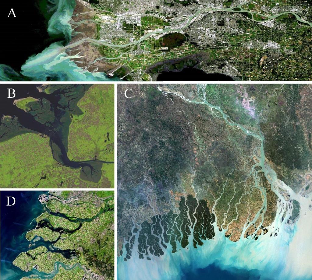
Estuary (WP2, WP4), C: the Ganges-Brahmaputru-Meghna Delta (WP2, WP3, WP4) and D: the Rhine-Meuse-
Scheldt Delta ((WP1, WP4). Image courtesy of the Department of Natural Resources, Canada (A), Royal
HaskoningDHV (B), Universal Images Group North America LLC / Alamy Stock Photo (C) and Pierre Markuse /
US Geological Survey (D).
Methods
Novel measurement techniques we have recently developed allow to acquire simultaneous observations of flow and suspended sediment transport, needed to bridge the knowledge gap between studies focused on bed form dynamics and the hydraulic roughness relevant for fluvial-tidal dynamics. With the advent of flexible mesh numerical simulation methods and comprehensive in-situ and remote sensing monitoring techniques, now is the time to develop realistic and idealized delta models that capture the complex feedbacks between flow, sediment transport and morphodynamics across the entire land-sea continuum. Dynamical systems theory will be employed to develop early warning indicators capable of predicting critical transitions in turbidity regime and delta channel morphology.
Individual projects
Roeland has a postdoc position within Deltas out of Shape. He works on developing regime shift theory, to select the most promising metrics for analysing critical slowing down in delta channels based on a literature survey. Subsequently, the development of an idealized Delft3D model capturing the regime shift from regular to hyperturbidity conditions is scheduled. For case studies including the Western Scheldt and the New Waterway, the likeliness of a critical transition to hyperturbid conditions will be analysed from existing long-term time-series of hydrodynamics and, when available, turbidity. The obtained insights will be translated to concrete guidelines for channel design. The aim is to establish early warning indicators for critical transitions in mixed fluvial-tidal channels and develop channel guidelines. Four main questions will be answered: 1) Are there indicators that can be used as early warnings of a critical transition to hyperturbidity? 2) Is there a dominant feedback mechanism causing rapid siltation of tidal channels? 3) Can early warning signals be identified announcing rapid siltation? 4) How can gained insights in tidal channel stability be employed for channel design?
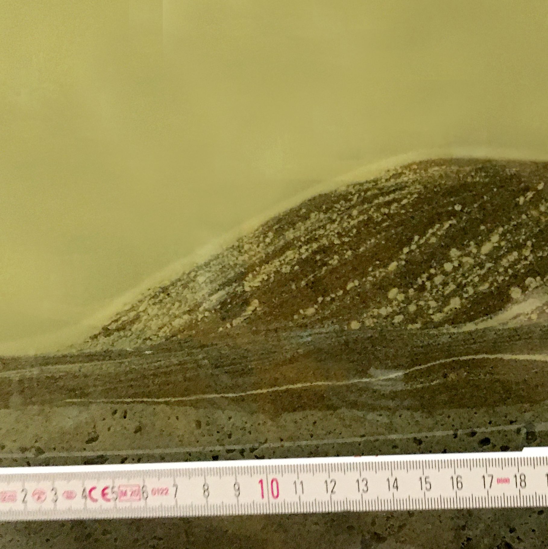
Sjoukje as a PhD candidate on the hydraulic roughness from bedforms. Bedforms are ubiquitous features in rivers and estuaries and play an important role in sediment transport by enhancing form roughness in the system. This study aims to determine the temporal and spatial dynamics of bedforms in different estuarine systems and relate this to hydraulic roughness. First, methodologies to determine hydraulic roughness from field measurements will be explored by examining a multi-year dataset of bathymetry and water levels of the river Waal, the Netherlands. Next, the spatial variability of bedforms in the fluvial to tidal transition zone (FTTZ) of the Fraser River will be qualitatively determined and related to environmental factors such as bed sediment characteristics. The field measurements will be complemented by laboratory research regarding the influence of cohesive sediment on dune dynamics. This research aims to contribute to a better understanding of roughness by bedforms, to improve the predictive capacity of operational models employed for improving delta liveability.
PhD candidate Nazwa works on the stability of tidal channels. The tide-dominated section of the eastern part of the GBM delta exhibits morphodynamic instability. The inherent natural instability is additionally challenged by anthropogenic influences such as land reclamation, construction of embankments and storm surge barriers, which can alter the tidal motion and contribute to the disappearance
of intertidal areas. Without intertidal areas, the flow may directly impinge on the river banks causing erosion and morphological instability, especially during extreme events such as storm surges, exacerbated by amplified tides. Nazwa hypothesize that intertidal areas and seasonality of river-tide interplay influence sediment dispersion mechanisms and geometry, causing the channels to be unstable. The aim of her project is to generate new knowledge on governing mechanisms in the GBM delta and to improve hydrodynamic and morphodynamic models to better understand channel instability, extending existing models for the GBM delta that do not yet account for intertidal areas and have limited consideration of tidal dynamics. Combining historic and remote sensing data, she aims to unravel changes in intertidal areas. The tidal dynamics and morphodynamic mechanisms behind channel instability will be captured by hydrodynamic and process-based models. The resultant findings will provide an objective understanding of observed instability in the GBM delta.
Reinier is employed as PhD candidate, and works on the morphodynamics of intertidal areas. Intertidal areas disappear in deltas worldwide because of land reclamation and sea level rise. This greatly impacts delta resilience as intertidal areas control tidal dynamics and the tidal motion acts to stabilize delta morphology. The role of intertidal areas on the morphological stability of deltas remains, however, to be explored. Existing stability relationships that relate hydraulic and geometric parameters to the tidal regime and associated residual transport patterns oversimplify the geometry and environmental conditions. This hampers applicability of these relationships to natural systems, where the geometry is complex. Furthermore, the interdependence between morphological change of the floodplains and forcing conditions may lead to increased channel instability, which has only been marginally explored to date. Therefore, Reinier’s study aims to quantitatively relate the morphodynamic stability of river-influenced estuaries to the dynamics of the intertidal areas.
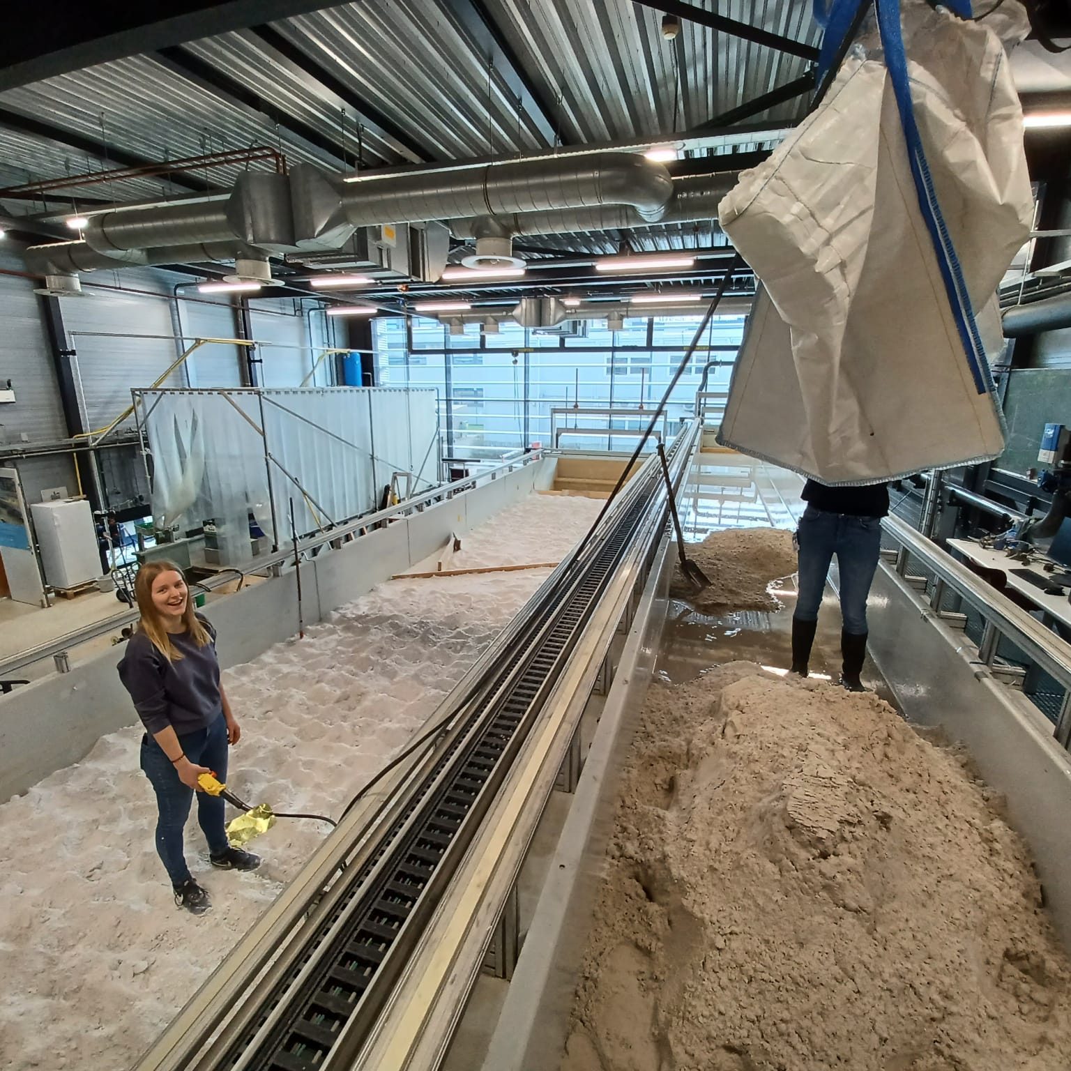
PhD candidate Joris got received a prestigious WIMEK grant to fund his own PhD project, which is now embedded within Deltas out of Shape. He works on the impact of storms on intertidal flats. To determine how a changing storm climate affects this valuable landscape while the sea level is rising, we need to understand the impact of individual storm events on the bed level of intertidal flats. This requires high spatiotemporal resolution measurements of the bed level and of the relevant drivers. So far, measurement campaigns are either characterized by a high spatial resolution or by a high temporal resolution. Unfortunately, bed level measurements that combine a high spatial and high temporal resolution are lacking. With the proposed project, Joris will resolve the fine scale response of tidal flats to individual storm events and further develop the conceptual understanding of storm impacts on intertidal flats. To this end we will use a combination of the following approaches: 1) a field-scale measurement campaign in the Western Scheldt estuary, employing video imaging (ARGUS monitoring station) and in-situ measurements; 2) detailed numerical modelling with Delft3D-FM and SWAN; and 3) reduced-complexity modelling. This strategy will allow to quantify the forming and destructing processes governing intertidal flat development and their variation over spatial and temporal scales. This understanding of fine-scale morphodynamics will allow to predict the behaviour of tidal flats under the pressure of a changing storm climate, which will help to develop estuarine best management practices that ensure humans, industry and nature can coexist in the years to
come.
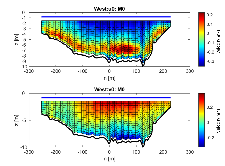
Shiyu achieved a grant from the Chinese Research Council (CRC), and now works on her PhD about the effect of human interventions on estuaries via computer modelling. She focusses on the Ems Estuary, an example of a heavily impacted estuary where suspended sediment concentration (SSC) levels are extremely high, crossing the boundary between the Netherlands and Germany. To meet the requirements of navigation, the tidal channels in the Ems Estuary have been substantially deepened by dredging over the past decades. This has led to tidal amplification and hyper-concentrated sediment conditions in the upstream tidal river. However, the detailed mechanism of enhanced up-estuary sediment transport is still poorly known. Shiyu aims to explore the mechanism of the residual up-estuary sediment transport in the human modified estuary of the Ems. The first objective is to determine the variation in flow asymmetry in time and space from hydrographic data including the near-bed layer. The second objective is to better understand the sediment transport patterns, especially in the deep channel part, where fluid mud is located. The third part of the study is to set up an idealized model to quantify the contribution of lateral and longitudinal currents to the residual sediment flux and to establish how they respond to changes in geometry, salinity-induced gradients, sediment-density-induced gradients and tidal forcing. In the last of the study, the above mechanisms will be analyzed using a full-complexity model of the Ems estuary.


Output
de Lange, S.I., van der Wilk, A., Chassagne, C., Ali, W., Born, M.P., Brodersen, K., Hoitink, A.J.F., & Waldschläger, K. (2024). Migrating subaqueous dunes capture clay flocs. Commun Earth Environ 5, 729 (2024). https://doi.org/10.1038/s43247-024-01901-x
Schrijvershof, R. A., van Maren, D. S., Van der Wegen, M., & Hoitink, A. J. F. (2024). Land reclamation controls on multi-centennial estuarine evolution. Earth’s Future, 12, e2024EF005080. https://doi.org/10.1029/2024EF005080
S.I. de Lange, I. Niesten, S.H.J. van de Veen, J.H. Baas, J. Lammers, K. Waldschläger, D. Boelee, and A.J.F. Hoitink (2024). Fine sediment in mixed sand-silt environments impacts bedform geometry by altering sediment mobility. Water Resources Research, 60, e2024WR037065. https:// doi.org/10.1029/2024WR037065
S.I. de Lange, R. Bradley, R.A. Schrijvershof, D. Murphy, K. Waldschläger, R. Kostaschuk, J.G. Venditti, A.J.F. Hoitink (2024). Dune geometry and the associated hydraulic roughness in the fluvial to tidal transition zone of the Fraser River at low river flow. JGR Earth Surface 129 (2). https://doi.org/10.1029/2023JF007340
S.I. de Lange & D. Sehgal, N. Martínez-Carreras, K. Waldschläger, V.F. Bense, C. Hissler, A.J.F. Hoitink (2024). The Impact Of Flocculation on In Situ and Ex Situ Particle Size Measurements by Laser Diffraction. Water Resources Research 60 (1). https://doi.org/10.1029/2023WR035176
R. A. Schrijvershof, D. S. van Maren, P. J. J. F. Torfs, A. J. F. Hoitink (2023). A Synthetic Spring-Neap Tidal Cycle for Long-Term Morphodynamic Models. JGR Earth Surface 128 (3). https://doi.org/10.1029/2022JF006799
S.I. de Lange, S. Naqshband, A.J.F. Hoitink (2021). Quantifying hydraulic roughness from field data: can dune morphology tell the whole story? Water Resources Research 57 (12). https://doi.org/10.1029/2021WR030329
